HAPPS

Dynamic Geo-Mapped Data Visualisation Web App

Overview:
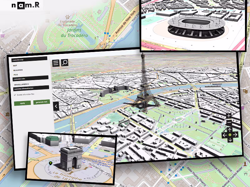
Happs is a dynamic geo-mapped data visualisation system that provides data which includes roads, buildings, trees, roofs and other elements belonging to an Urban area, which customizes the data according to the structured queries.

Features:

  • Real time Geo-Mapping data visualization with a high level of detail and accuracy-2D & 3D Options
  • 3D representations of urban areas with roads, trees, landscape, buildings, Daylight Mode, Roofs & Windows generated on runtime, 100+ different types of Raster etc.
  • 360 degree videos
  • Interactive 3D Maps
  • Customization Elements
  • 3D printing
  • VR & AR experiences
  • Multiple selection of buildings to acquire consolidated data at once.

GET IN TOUCH

From budding SMBs to deep rooted Fortune companies we have worked with them all. You’ll be enthralled by our broad service offerings. After you give us your requirements we’ll get going like there’s no tomorrow.


Request A Quote
Request A Quote

TRUSTED BY THE WORLDS LEADING BRANDS

WE'D

LOVE TO WORK WITH YOU

Please submit your requirements below & we will get in touch with you shortly

Looking for Career Opportunities? Click Here!